Modena Flood Showcase
Secchia river 2014 flooding event
The largest and most economically important river basin in Italy is the Po Valley, stretching from the Alps in the North of the country to the Adriatic Sea on the East coast. It comprises the Po River basin, the eastern lowlands of Veneto and Friuli and the south-eastern basins of Emilia–Romagna. Nearly half of the national GDP is produced in the basin area from one third the country’s industries, including a large agricultural output. It is also significantly populated, with 17 million people living within its eight regions. Flooding has traditionally been a risk in this area, with protection provided by the likes of embankments, hydraulic works, and levees.
Specifically, in the lower part of the Po River, flood-prone areas have been protected by a complex system of embankments and hydraulic works that are part of the complex flood defense system in the Po Valley, extending for almost 3000 km as a result of a tradition of river embanking lasting centuries. Within the south-eastern part of the basin, one of the most at-risk area for river flooding, the city of Modena (Emilia Romagna) can be found. The city is flanked by two tributaries to the Po River, these being the Secchia River to the west and the Panaro River to the east. A significant flooding event occurred on this area in 2014, when on January 19th, in combination with a long-lasting stratiform rainfall event, a portion of the artificial levee protecting the area from the Secchia River collapsed, with water breaching and inundating the surrounding plain.
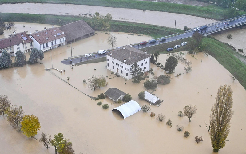
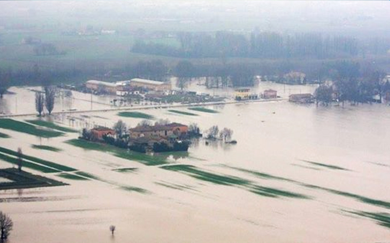
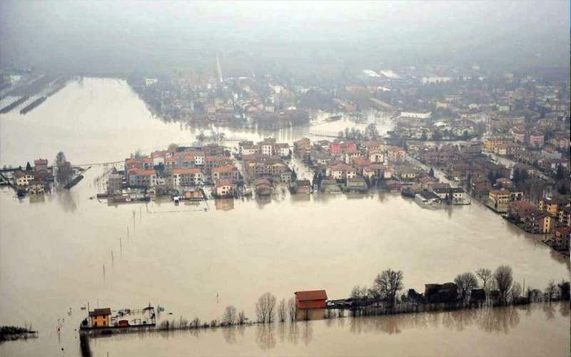
A similar potential levee failure was later spotted on the Panaro River and fixed, however the situation in Secchia could not be averted. The impacts were widespread and devastating for many. Over 50km2 was flooded at an average depth of 1m, displacing thousands and causing one fatality. Nearby towns such as Bastiglia and Bomporto felt the impacts hardest, with the duration of flooding exceeding two full days. The economic damage was particularly severe, reaching an estimated €400 million, including €36 million worth of damage to residential properties, according to damage declaration.
Available data and expected uses of data
There is significant data available for this area in terms of damages on residential buildings, in the form of household insurance declarations following the 2014 flooding event. This includes economic information on affected housing, mobile goods, shared structures and registered goods, as well as building use and typology, all available by municipality.
The detailed nature of the data available for the showcase gives the opportunity for a wide variety of potential applications. Flood-related impacts could be demonstrated through the analysis of this data, improving risk and damage modelling capacity for both the residential and the productive sector.