Greece showcase in a nutshell – The Kefalonia island
26 January / 3 February 2014 Kefalonia island Earthquakes
Kefalonia island is located in the Ionian Sea, in Greece. Greece has the highest seismicity in Europe and the 6th globally and is divided into three seismic hazard zones I, II, III with ground accelerations (A=ag) 0.16, 0.24, 0.36g respectively. Kefalonia island is located in the seismic hazard zone with the highest seismicity (ag=0,36g) and has a long seismic history. In 1953, the island was completely destroyed by a sequence of destructive shocks that caused more than 450 deaths.
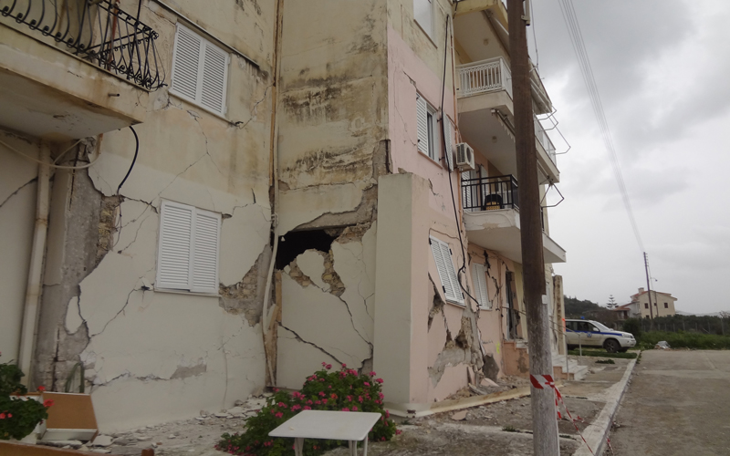
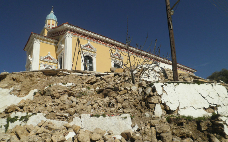
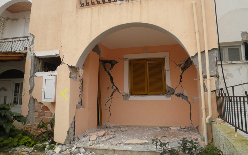
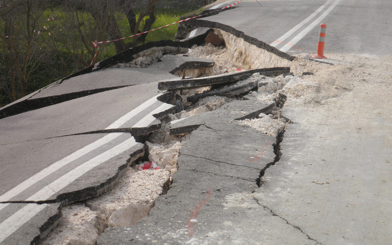
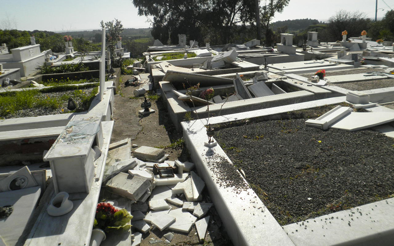
On January 26 (15:55 local time) and February 3 (05:08 local time) 2014, Kefalonia Island was struck by two major earthquakes with magnitudes M6.1 and M6.0, respectively. The ground shaking was felt except from Kefalonia, on the other Ionian islands, on several areas of western Greece, in large part of continental Greece and in south Italy and Albania. Fortunately there were no deaths. Most of the structural damage was concentrated in the Paliki peninsula area, on the western part of the island. There was extensive damage to buildings, infrastructure, road network and water supply network especially in the town of Lixouri. The churches of the island exhibited extensive structural damage. Significant problems were caused due to landslides and rock falls. The impact of nonstructural damage was substantial in the function and the economy of the island, causing business to stop operating (banks, restaurants, stores etc) and the airport of the island was shut down for several days.
After the Kefalonia earthquake, an operation of emergency inspection of buildings was carried out (post- earthquake inspection procedure) and included two degrees of inspection. The buildings were inspected in order to be classified in categories regarding their usability and damages.
Available data and expected uses of data
Before the earthquake of Kefalonia, a pre – earthquake assessment for existing buildings of public use, was carried out in the island of Kefalonia. The Earthquake Planning and Protection Organization (OASP) is responsible for the implementation, collection of the data and validation of the above mentioned pre – earthquake assessment procedure, in the framework of Vulnerability Mitigation of Buildings in Greece.
The case study will provide useful information to LODE, mainly by comparing the data from the pre- earthquake assessment (which is available in OASP) with the data collected from the post- earthquake damage assessment of the same buildings after the 2014 earthquakes in order to validate the existing procedures. Additionally the transferability of vulnerability and damage assessment procedures in other insular areas in Greece, Italy, France, or Spain will be examined.
After the Kefalonia island earthquake several studies and reports were carried out from public and private entities thus useful data will be provided regarding structural response, damage to infrastructure lifelines, nonstructural components as well as data concerning economical loses, which will be of great use in calibrating risk assessment models.